Supervised by: Dawn Scott (NTU) and Marine Servonnat (Ingwe Research Program)
Short term goal: To understand which landscape characteristics are the most significant predictors of overall roadkill occurrence and the spatial location of roadkill hotspots.
Long term goal: Reducing roadkill on the R40 by at least 80% through the implementation of solutions such as Road Animal Detection Systems.
Research questions about the following topics are explored:
Comparison and Robustness of Roadkill Survey Methods (Citizen Science vs. Patrols)
Influence of Landscape Characteristics on Roadkill Occurrence
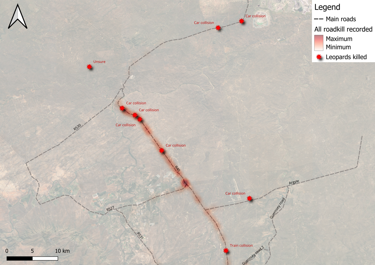
One of the 8 leopards killed on the road in our area of operation
Methodology:
1. Systematic Roadkill Surveys To establish a baseline of wildlife mortality, we conduct standardized roadkill patrols along a 47km stretch of the R40.
Sampling Effort: Surveys are conducted over three 14-day intensive blocks per season (Dry and Wet), totaling 42 survey days per season.
Protocol: Patrols are carried out at a constant average speed of 45 km/h to maximize detection probability.
Timing: Surveys commence 90 minutes after morning civil twilight to ensure optimal visibility and capture fresh overnight data.
Data Collection: For every incident, we record 10 distinct variables—including habitat type, distance to closest barrier, and road curvature—to identify the factors influencing roadkill hotspots.
2. Opportunistic Citizen Science To supplement our systematic data, we leverage local knowledge through a dedicated "Citizen Science" network.
Reporting: Local residents and commuters report sightings via a monitored WhatsApp group.
Verification: Contributors provide a GPS location, date/time, species identification, and a photographic record. This allows us to track mortality trends across the entire year, filling the gaps between our intensive survey blocks.
The methodology and fieldwork design for our road ecology project were developed with the expert support of Dr. Wendy Collinson, Dr. Thabo Hlatshwayo and Dr Clara Grilo. Their guidance was instrumental in establishing the project’s scientific foundation and conceptual framework.
Preliminary Results
Focus data from our ongoing monitoring of a 47km stretch of the R40 reveals a significant impact on local biodiversity. Initial comparisons between Citizen Science reports and our dedicated patrols show distinct recording trends: Reptiles (11% vs. 13%), Mammals (65% vs. 37%), and Birds (24% vs. 50%).
With 198 roadkill mortalities documented in just 84 days, a year-long extrapolation suggests a loss of approximately 860 animals annually on this single stretch of road. These preliminary figures underscore the urgent need for long-term mitigation strategies.
In total, we have recorded 23 mammal species that we could positively identified and we have 10 mammals with uncertainty regarding the species. The species recorded include African Wild Cat (3), Banded mangoose (5), Black-backed jackal (6), Civet (19), Porcupine (15), Scrub hare (17), Spotted Hyena (5), Vervet monkey (10), just to name a few. The most killed birds are yellow billed & red-billed hornbills (28) and the most killed reptiles ar Rock monitor (10).
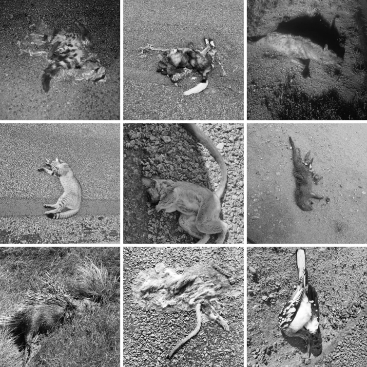
Some of the animals recorded during patrols or by citizen scientists.
Roadkill recorded during patrol (84 days total throughout the wet & dry season) and by citizen scientists from February 2025 to March 2026
Heatmap of roadkill recorded during patrols and by citizen scientists, showing where leopards were killed.
The most likely cause of death of the "unsure" leopard is vehicle collision, which pause the question: how many leopards are hit but do not die on impact and stumble away from the road and die?
About this Project
Partners & Sponsors
Join Us in Conservation Efforts
Make a donation and help protect leopards and their habitats in South Africa.

.jpeg)