Short term goal: Maintaining and expanding our robust network of reserves and to standardize data collection, establishing a robust baseline of the regional leopard population
Long term goal: To determine if citizen science data can reliably estimate population density and to understand how leopards adapt their movement & home ranges with time and in a peri-urban environment.
Data Collection: The Ingwe App
All sightings and camera trap data are now funneled through our custom-built mobile app.
Incidental Sightings recorded by residents and field guides.
Private Camera Trap Network: data from hundreds of existing, privately-owned camera traps
Available on the PlayStore & AppleStore
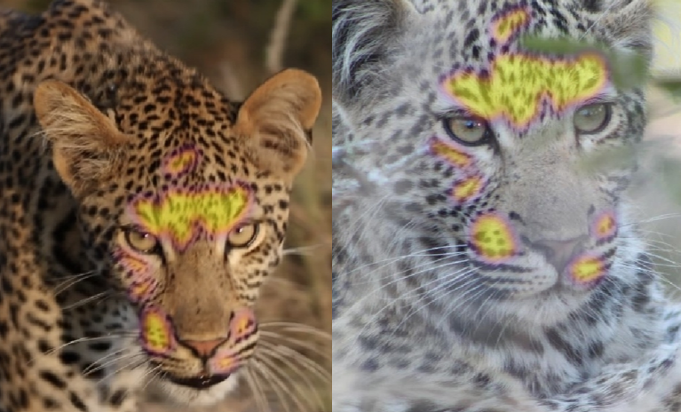
AI Identification & Analysis
Every image and video is processed through ArgusWild.AI. This AI-driven platform allows us to:
Identify Individuals: Track unique leopards via coat pattern recognition.
Map Dynamics: Analyze co-occurrences, family relationships, and specific home ranges.
Track Movement: Monitor how individuals navigate through different properties and the peri-urban landscape.
ArgusWild AI
Field Update
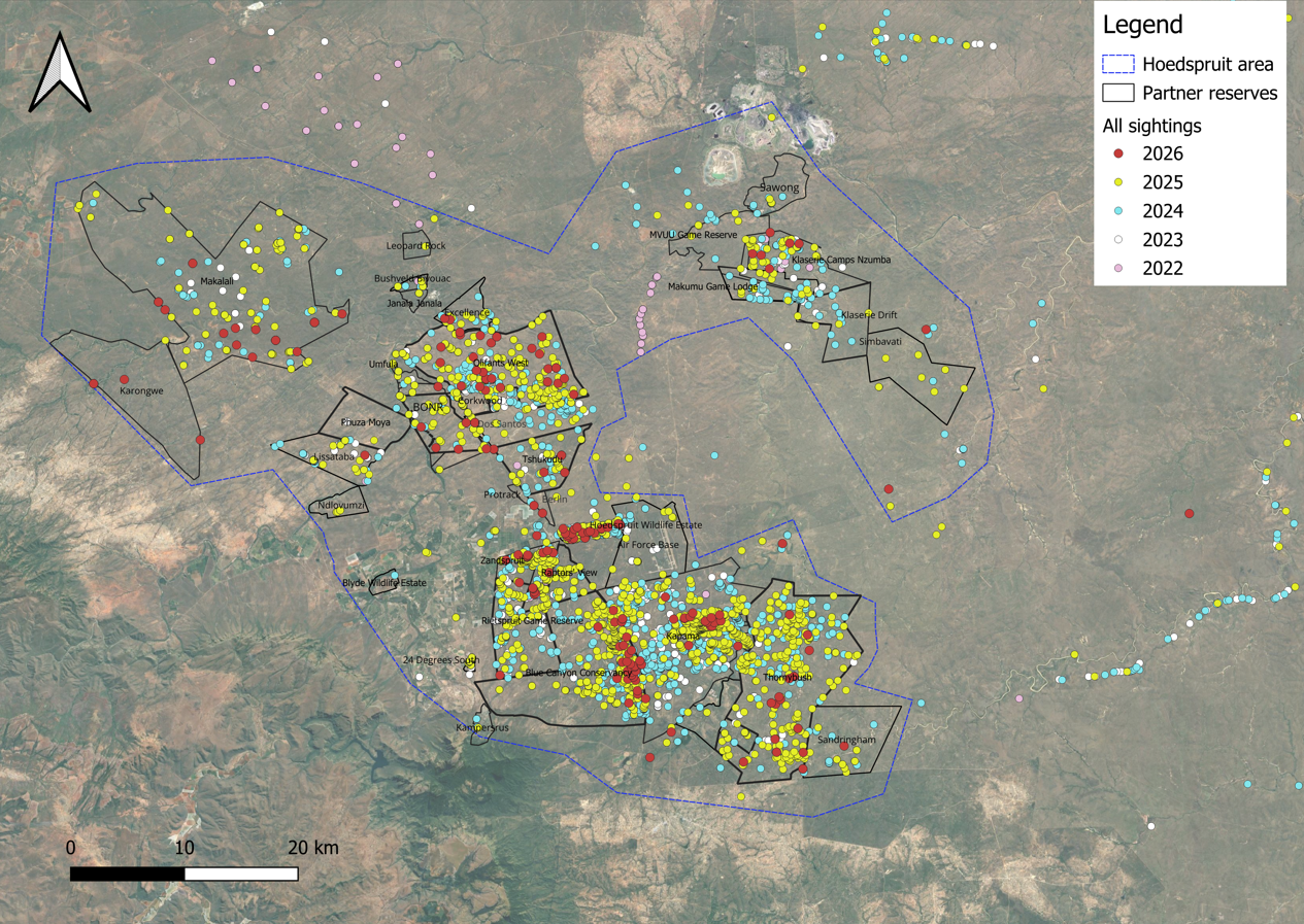
Since our journey began in January 2023, the scale of community involvement in our leopard research has been staggering. What started as a local initiative has grown into a massive database that is redefining how we understand leopard dynamics in the Greater Kruger region.
Over 14,000 sightings submitted by our citizen scientists. Map updated in March 2026.
A New Era: The Ingwe App
In the early phases of our project, data collection was a fragmented process involving third-party apps, spreadsheets from our ambassadors, and thousands of private messages. While this built our foundation, we have now transitioned to a unified, custom-built mobile app to lead our research into the future.
Why the switch?
Standardization: All data is now captured in a uniform format, ensuring high-grade scientific accuracy.
Scalability: The app allows us to onboard more participants across a wider geographic area.
Direct Feedback: It bridges the gap between the researcher and the contributor, making conservation a shared experience.
We believe that those who contribute to science should benefit from the results. Depending on user rights and access levels, app contributors can now:
Receive the specific ID of the leopard they sighted.
View identification guides to help them recognize local leopards in the field.
See real-time mapping of where specific leopards occur and how they move across the landscape.
Keep track of all the leopards they have ever seen and where.
Read our Privacy Policy and App Consent form here.
Looking Ahead
As we continue to grow, our focus remains on turning these thousands of data points into actionable conservation strategies. By understanding exactly how our leopards are moving through an increasingly busy landscape, we can better advocate for the corridors they need to survive.
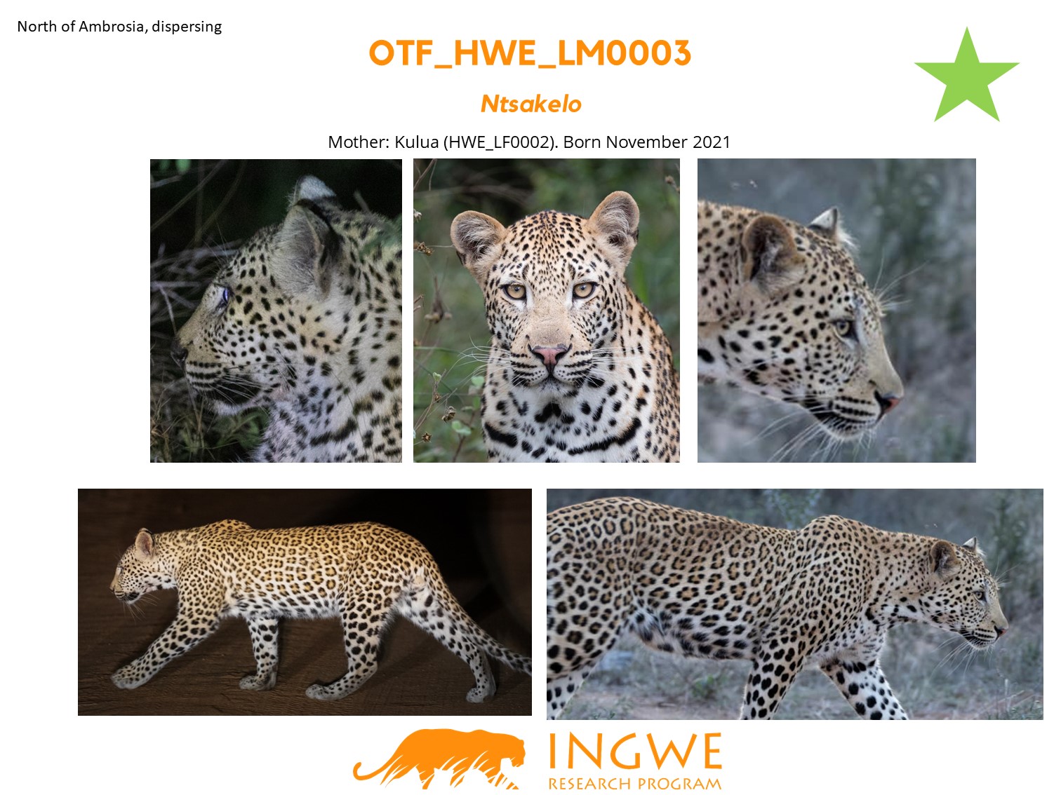
Our vast network of citizen scientists, reserves & lodges allow us to track leopard movements across the landscape and understand the dynamics between the different individuals. We have tracked individual leopards who have dispersed over 50km between reserves, an information that would have never been available without this network.
About this Project
Partners & Sponsors
Join Us in Conservation Efforts
Make a donation and help protect leopards and their habitats in South Africa.

.avif)


.avif)


.avif)

.avif)


.avif)


.avif)

.avif)


.avif)

.avif)
